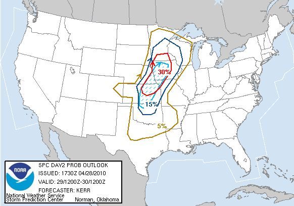
Storm Prediction Center's Slight Risk area for Thursday
We are carefully watching for the possibility of some strong to severe storms over southern Minnesota during the late afternoon and evening Thursday. Currently the Storm Prediction Center has a Slight Risk of Severe Storms over much of southern Minnesota for Thursday as a cold front and low pressure area approaches the area.
Some concerns over the formation of these storms though. It looks as though over a good portion of the Slight area, stretching down to Oklahoma, will be capped, which would limit formation of storms until the cap is broken (think of a shaken up bottle of pop. The energy can't be released until you unscrew (remove) the cap).
Also, at least up in our neck of the woods, we have a dry atmosphere, which will only help set off any storms that we do get.

Percent probability of severe weather within 25 miles of a point -- Hatched (blue dashed area) is probability of significant severe weather within 25 miles of a point
The main threat that should occur with these storms in our area is large hail and some damaging winds. I won't rule out an isolated tornado or two, mainly in southern Minnesota (south of the cities), but the main tornado action (along with the main severe weather event) should be from Iowa down toward Kansas in the afternoon and evening.
I do not think that this will be a big outbreak in our area - more an isolated event. We could see a bigger outbreak, including tornadoes, as the system pushes eastward into Wisconsin, Iowa, Illinois, and south through Louisiana and Mississippi on Friday.

No comments:
Post a Comment