Saturday, May 30, 2009

Severe Weather Threat on Sunday

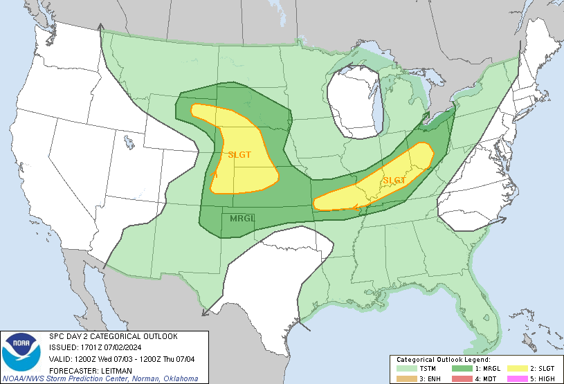
We are looking at the possibility of some severe weather developing around the area during the afternoon and evening hours on Sunday. The slight risk area currently encompasses an area along and south of a line from Wahpeton to Menahga to Pequot Lakes to Aitkin to Moose Lake to Hayward all the way down through a good portion of Iowa. The outlook also shows there is a 30% circle (in other words, a greater chance) of the severe weather stretching from Ortonville to Glenwood to STC to the Twin Cities and southward.

Storms will form along an approaching cold front during the afternoon hours on Sunday. Within the first few hours of storm initiation there should be enough energy to develop some discrete supercell thunderstorms. These will be capable of large hail, damaging winds, and the possibility of a couple stray tornadoes in the mix, though it is looking the greatest risk of any tornadoes may be in SD and NE.

Approaching the evening, the storms will likely become more linear and move southeastward. During this phase the threat will mainly be large hail and damaging winds.

According to the NWS in Chanhassen, the greatest threat will be from noon to 7 PM, especially from the northern portion of the area (including STC, Alex, and Willmar).

Overall, tomorrow could turn out to be interesting. Tomorrow could still turn out to be a bust for the area. Stay tuned and we will update as needed.


Thursday, May 28, 2009

Nice Start to Weekend, But Turning Stormy?

First, we'll start with your Friday weather. Friday looks pretty nice, there is the chance of a scattered shower or storm, otherwise a mix of clouds and sun with a high around 74.

Saturday definitely looks like the better of the two days this weekend. Even though we will only reach a high of 74, it will be mainly sunny out.

Sunday we will reach 80 but a strong cold front comes in from the north, bringing with it clouds, showers, and storms. Some of these storms from St. Cloud southward could be strong to severe with large hail and damaging winds, but the best severe weather chances will be south and east of the area (we're talking into southern MN/IA and over into the Great Lakes area.) Tornadoes don't look as likely at the moment, but could be on Monday as the system pushes south into MI, NE, and KS -- definitely far clear of the MN area.

Friday, May 15, 2009

Today's Severe Weather Threat as of 335 PM

Update 335 PM: More stronger storms are pushing into the area associated with the same line. According to the National Weather Service:

AT 322 PM CDT...WEATHER SERVICE RADAR WAS TRACKING STRONG THUNDERSTORMS 11 MILES EAST OF PAYNESVILLE AND EXTENDING TO COLD SPRING. THESE STORMS WERE MOVING NORTHEAST AT 40 MPH.

PEA TO ONE HALF INCH DIAMETER HAIL AND WINDS UP TO 50 MPH ARE EXPECTED WITH THIS STORM THROUGH 430 PM CDT.

* LOCATIONS IN OR NEAR THE PATH OF THIS STORM INCLUDE... ST NICHOLAS. COLD SPRING. ROCKVILLE. LUXEMBURG. ST AUGUSTA. ST CLOUD.

Watch out if you are heading out soon for some downpours, small hail, and lightning.

Update 235 PM: Stronger storms moving through the St. Cloud area right now. Will be capable of 1/2" hail and wind gusts of 40 mph. Once the line passes through I think that will be the main batch of rain for the night in the area unless a line around the Fargo area gets its act together and forms southward.

Original Post: We are watching an increasing threat of severe storms later this afternoon and evening over a good portion of Minnesota. A Slight Risk of Severe Storms has been places in portions of northern, central, and eastern Minnesota, mainly for the threat of large hail and some damaging winds. The Storm Prediction Center has issued Mesoscale Discussion 832 talking about the threat, and saying that a Severe Thunderstorm Watch could be issued within the next few hours (with storm development underway right now). Storm can currently be seen in eastern Stearns as of 2 PM and moving towards the STC area. Will update later today with more information, plus is there is any watches issued.

A few links to keep you entertained until I can update
SPC Mesoscale Discussion 832
Fox 9 My Live Weather Chatroom

Friday, May 1, 2009

The Weekend Forecast: Anyone say sun?

Yay, its the first day of May! We should have more moderation in temperature over the next few weeks as we start leaving college for the summer and heading towards Memorial Day. This is going to be typical, reasonable, very nice spring weekend -- maybe a weekend for you to take your studying for finals outside instead of the stuffy indoors!

For the rest of Friday, we could see a spare shower, mainly to our north though, with a high around 57.

Saturday has clearing skies and 61.

Sunday has mainly sunny skies and 63.

Temps will stick in the middle to upper 60s, even approaching 70 next week, but next week also looks a bit more stormy. Not sure there will be enough ingredients to put together for severe weather, but that will be coming soon enough as we get deeper into the summer ahead of us.

We are helping spread the word of the Vortex2 project occurring in the next couple months: Weather Channel: Vortex2 Project