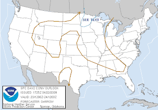
 The Friday Outlook as of 12:30 PM this afternoon is to the left. There is thinking that the storms that'll form late day and overnight in the region along a cold front moving through will cause the possibility of mainly large hail. It is unclear though how much moisture will actually reach these areas tomorrow to help fuel the storm growth and any hail growth. The greatest risk of any severe weather is in that blue "SEE TEXT" area that I drew in for your viewing pleasure. This is not going to be a big severe threat, it will likely be just scattered storms. I doubt this will be raised to a Slight Risk tomorrow, and I doubt any watches will have to be issued for the area. It's just something to look out for late late tomorrow and into the overnight.
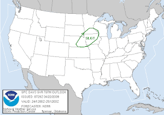
 This is the severe weather threat for your Saturday as of early this morning, and they have issued a Slight Risk of Severe Storms from about the Twin Cities southward, through Iowa and into Nebraska. It is thought there will be enough energy to break the cap on the atmosphere in the afternoon in eastern Nebraska and western Iowa, allowing for the formation of individual storms. While the primary threats will be very large hail and damaging winds in these areas, wind profiles hint that there may be a possibility of a few tornadoes. The storms will then form into a line towards the evening time frame, and damaging winds will become the main threat along with large hail as the system looks to push north and east.
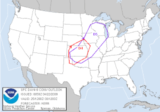
 This is the Days 4-8 outlook issued early this morning, and as you can see there will be another severe weather threat on Day 5 (Sunday) from the Twin Cities south and eastward. As this threat is days out, its not as easy to say what type of severe weather could be possible, but right now we could see individual cells form to the south, possibly leaving the chance open for tornadoes down south along with damaging winds and large hail, but then form into one or more lines, creating the biggest threat for damaging winds and large hail at that time.
While I am talking about the possibility of these severe threats, there is nothing that says these chances won't happen and fizzle out, especially the Thursday chance. It's good to stay informed though! Thursday is also Tornado Day in Minnesota, we'll have more on that tomorrow.
DJ

No comments:
Post a Comment