Saturday, May 30, 2009

Severe Weather Threat on Sunday

We are looking at the possibility of some severe weather developing around the area during the afternoon and evening hours on Sunday. The slight risk area currently encompasses an area along and south of a line from Wahpeton to Menahga to Pequot Lakes to Aitkin to Moose Lake to Hayward all the way down through a good portion of Iowa. The outlook also shows there is a 30% circle (in other words, a greater chance) of the severe weather stretching from Ortonville to Glenwood to STC to the Twin Cities and southward.

Storms will form along an approaching cold front during the afternoon hours on Sunday. Within the first few hours of storm initiation there should be enough energy to develop some discrete supercell thunderstorms. These will be capable of large hail, damaging winds, and the possibility of a couple stray tornadoes in the mix, though it is looking the greatest risk of any tornadoes may be in SD and NE.

Approaching the evening, the storms will likely become more linear and move southeastward. During this phase the threat will mainly be large hail and damaging winds.

According to the NWS in Chanhassen, the greatest threat will be from noon to 7 PM, especially from the northern portion of the area (including STC, Alex, and Willmar).

Overall, tomorrow could turn out to be interesting. Tomorrow could still turn out to be a bust for the area. Stay tuned and we will update as needed.


Thursday, May 28, 2009

Nice Start to Weekend, But Turning Stormy?

First, we'll start with your Friday weather. Friday looks pretty nice, there is the chance of a scattered shower or storm, otherwise a mix of clouds and sun with a high around 74.

Saturday definitely looks like the better of the two days this weekend. Even though we will only reach a high of 74, it will be mainly sunny out.

Sunday we will reach 80 but a strong cold front comes in from the north, bringing with it clouds, showers, and storms. Some of these storms from St. Cloud southward could be strong to severe with large hail and damaging winds, but the best severe weather chances will be south and east of the area (we're talking into southern MN/IA and over into the Great Lakes area.) Tornadoes don't look as likely at the moment, but could be on Monday as the system pushes south into MI, NE, and KS -- definitely far clear of the MN area.

Friday, May 15, 2009

Today's Severe Weather Threat as of 335 PM

Update 335 PM: More stronger storms are pushing into the area associated with the same line. According to the National Weather Service:

AT 322 PM CDT...WEATHER SERVICE RADAR WAS TRACKING STRONG THUNDERSTORMS 11 MILES EAST OF PAYNESVILLE AND EXTENDING TO COLD SPRING. THESE STORMS WERE MOVING NORTHEAST AT 40 MPH.

PEA TO ONE HALF INCH DIAMETER HAIL AND WINDS UP TO 50 MPH ARE EXPECTED WITH THIS STORM THROUGH 430 PM CDT.

* LOCATIONS IN OR NEAR THE PATH OF THIS STORM INCLUDE... ST NICHOLAS. COLD SPRING. ROCKVILLE. LUXEMBURG. ST AUGUSTA. ST CLOUD.

Watch out if you are heading out soon for some downpours, small hail, and lightning.

Update 235 PM: Stronger storms moving through the St. Cloud area right now. Will be capable of 1/2" hail and wind gusts of 40 mph. Once the line passes through I think that will be the main batch of rain for the night in the area unless a line around the Fargo area gets its act together and forms southward.

Original Post: We are watching an increasing threat of severe storms later this afternoon and evening over a good portion of Minnesota. A Slight Risk of Severe Storms has been places in portions of northern, central, and eastern Minnesota, mainly for the threat of large hail and some damaging winds. The Storm Prediction Center has issued Mesoscale Discussion 832 talking about the threat, and saying that a Severe Thunderstorm Watch could be issued within the next few hours (with storm development underway right now). Storm can currently be seen in eastern Stearns as of 2 PM and moving towards the STC area. Will update later today with more information, plus is there is any watches issued.

A few links to keep you entertained until I can update
SPC Mesoscale Discussion 832
Fox 9 My Live Weather Chatroom

Friday, May 1, 2009

The Weekend Forecast: Anyone say sun?

Yay, its the first day of May! We should have more moderation in temperature over the next few weeks as we start leaving college for the summer and heading towards Memorial Day. This is going to be typical, reasonable, very nice spring weekend -- maybe a weekend for you to take your studying for finals outside instead of the stuffy indoors!

For the rest of Friday, we could see a spare shower, mainly to our north though, with a high around 57.

Saturday has clearing skies and 61.

Sunday has mainly sunny skies and 63.

Temps will stick in the middle to upper 60s, even approaching 70 next week, but next week also looks a bit more stormy. Not sure there will be enough ingredients to put together for severe weather, but that will be coming soon enough as we get deeper into the summer ahead of us.

We are helping spread the word of the Vortex2 project occurring in the next couple months: Weather Channel: Vortex2 Project

Friday, April 24, 2009

Severe Weather Threat Diminishes and Your Weekend Forecast

Ha, who could have saw this one coming? The severe threat for today has moved south and east of the Twin Cities, so I don't expect much severe weather to occur at all in Minnesota later today according to the current maps, and there isn't a chance for severe weather the rest of the weekend. We will still see scattered showers and storms today around the area (temps around 60, but falling), that will become more numerous overnight. Showers continue into the morning Saturday, but will taper off and the afternoon, while it will be cooler (around 50), at least won't be rainy. More rain and thunderstorms will move back into the picture Saturday Night and last into Sunday, but will be even cooler (around 45). Get yourselves ready for a wet weekend!

SWAW, Day 5: Heat Waves

It's Severe Weather Awareness Week in MN and WI, which means its time to start going over what everything is again and what precautions to take when severe weather strikes. While no major heat is in the forecast, some severe weather might be, so now is as good as time as any to relearn what we do in summertime, like how we have to relearn the winter warnings (and how to drive) in the winter. Remember, throughout the summer we'll cover it the best we can on Facebook, Twitter, and now Blogger. Today's topic, brought to you by the National Weather Service, is Heat Waves -- I've also included what watches, warnings, and advisories there are for heat.

Heat Waves (can also find more from this NWS Publication on Heat Waves)

Watches...
Excessive Heat Watch: In Hennepin and Ramsey counties: Maximum heat index at Minneapolis/St. Paul International Airport is expected to reach 105 or greater for 1 day, or the maximum heat index is expected to reach 100 or greater and an overnight low temperature no cooler than 75 for 2 days in a row. In addition, the Heat Watch/Warning System must recommend a watch.
Excessive Heat Watch: Outside Hennepin and Ramsey counties: Maximum heat index reaches 105 or greater and a minimum heat index of 75 or greater for at least 48 hours.

Warnings...
Excessive Heat Warning: In Hennepin and Ramsey counties: Maximum heat index at Minneapolis/St. Paul International Airport reaches 105 or greater for 1 day, or the maximum heat index reaches 100 or greater and the overnight low temperature is no cooler than 75 for 2 days in a row. In addition, the Heat Watch/Warning System must recommend a warning. A warning may also be issued if advisory criteria are expected for 4 days in a row.
Excessive Heat Warning: Outside Hennepin and Ramsey counties: Maximum heat index reaches 105 or greater and a minimum heat index of 75 or greater for at least 48 hours. A warning may also be issued if advisory criteria are expected for 4 days in a row.

Advisories...
Heat Advisory:
In Hennepin and Ramsey counties: Maximum heat index at Minneapolis/St. Paul International Airport is expected to reach 105 or greater for 1 day, or the maximum heat index is expected to reach 100 or greater and an overnight low temperature no cooler than 75 for 2 days in a row.
Heat Advisory: Outside Hennepin and Ramsey counties: Maximum heat index reaches 100 and/or the maximum temperature reaches 95 or higher.

Minnesota's Deadliest Weather Factor Since 1990...
The second greatest number of weather fatalities in Minnesota since 1990 has been due to excessive heat. Fourteen people have died from high heat and humidity. Only flooding has killed more people in the last 18 years.

Wisconsin's Deadliest Weather Factor Since 1982...
The greatest number of weather fatalities in Wisconsin since 1982 has been due to excessive heat. 116 people have died from high heat and humidity. This total is more than tornadoes, flooding, blizzards or anything else. The 1995 summer heat waves hold the record as the number one weather-related killer in Wisconsin since it became a state in 1848. Most deaths occurred in the major urban areas in southeast Wisconsin, but there have been a number of fatalities in the rest of the state as well.

Fortunately, there were no deaths last year from excessive heat in either WIsconsin or Minnesota.

In the last 10 years, a national average of 219 people have died as a result of health problems directly related to excessive heat. Considering this death toll, the National Weather Service has stepped up its efforts to more effectively alert the general public to the hazards of heat waves.

Based on research findings, the National Weather Service devised the Heat Index (HI). It is an accurate measure of how hot it really feels when the relative humidity is added to the actual air temperature. It is important to note that since heat index values were devised for shady, light wind conditions, exposure to full sun can increase values by up to 15 degrees.

Heat disorders generally have to do with a reduction or collapse in the ability of the body to shed heat by circulatory changes and sweating. In other words, a chemical imbalance caused by too much sweating. When heat gain exceeds the level the body can remove, or when the body cannot compensate for fluids and salt lost through perspiration, the inner-core temperature of the body begins to rise and heat-related illnesses may develop. Ranging in severity, heat disorders share one common feature: the individual has over-exposed or over-excerised for his/her age and physical condition in the existing thermal environment.

Sunburn, with its ultraviolet radiation burns, can also significantly retard the ability of skin to shed excess heat.

Safety tips...
The National Weather Service will issue advisories or warnings when the heat index is expected to have a significant impact on public safety. The common guidelines for the issuance of excessive heat warnings is when the maximum daytime index is expected to reach 110 or 115, and the nighttime low temperature does not fall below 75 or 80 degrees.

Here are some tips to follow to ensure that heat-related problems do not impact you...

  • Slow down. Strenuous activities should be reduced, eliminated or rescheduled to the coolest time of the day. Individuals at risk should stay in the coolest available place, not necessarily indoors. Dress for summer. Lightweight, light-colored clothing reflects heat and sunlight and helps your body maintain normal temperatures.
  • Put less fuel on your inner fires. Foods such as proteins that increase metabolic heat production also increase water loss.
  • Drink plenty of water or other non-alcoholic fluids. Your body needs water to keep cool. Drink plenty of fluids, even if you don't feel thirsty. However, those who suffer from epilepsy, heart, kidney or liver disease, are on fluid restrictive diets, or have a problem with fluid retention should consult a physician before increasing their consumption of fluids.
  • Do not drink alcoholic beverages.
  • Spend more time in air-conditioned places. Air conditioning in homes and other buildings markedly reduces danger from the heat. If you cannot afford an air conditioner, spending time each day in an air-conditioned environment during hot weather affords some protection.
  • Be careful not to get too much sun. Sunburn makes the job of heat dissipation that much more difficult.

Thursday, April 23, 2009

A Look at the Severe Chance Friday

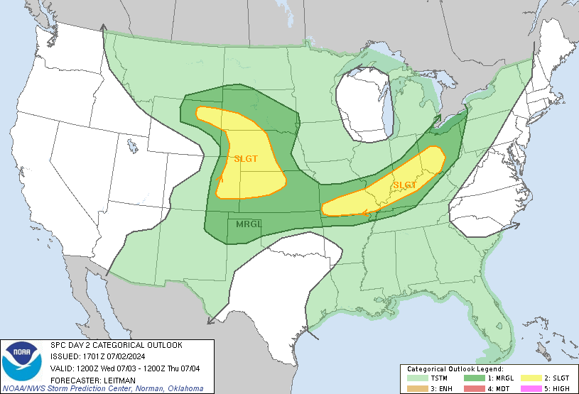
This is the latest outlook for Friday from the Storm Prediction Center, and its a probabilistic outlook, showing where the higher chances of severe storms are. As a quick overview for those of you who don't know what everything means on this map, the numbers represent the probability of severe weather within 20 miles of any given location. Within the blue slanted "hatched area" there is at least a 10% risk of "significant severe weather" within 25 miles of any point. Typically in these blue marked territories we look for the worse weather of the day, whether it be large hail, damaging winds, or tornadoes. From looking at everything, I agree with this "hatched area". The greatest risk of severe weather will be in the Iowa and Nebraska areas, and might contain very large hail, damaging winds, and a few tornadoes. Cities in this area would include Sioux Falls and Sioux City. Parts of Wisconsin also have a higher chance of severe weather, but that will mainly be in the large hail and damaging wind categories. So according to the graphics I have looked at, the greatest threat of severe weather will be definitely south and east of the STC area. The closer you get to Iowa or Wisconsin tomorrow, though, the more the odds go up of seeing severe storms. Cities such as Fairmont, Mankato, Worthington, and Albert Lea, and even the Twin Cites will need to be on the lookout tomorrow. As you can see, this area is also really close to the STC area. More than likely the cold front will have pushed southward enough to keep us out of the severe area, but even so people in the STC area should keep a look out for the possibility of severe weather since the boundaries are still so close to the area. Watches and warnings are likely tomorrow, especially in NE/IA/WI... I'll be updating if any of these decides to strike close to home. Also, expect an update by 2 PM tomorrow on the latest on the severe weather threat for the area.